Indian Magazine Applauds the Poetic Genius of a Kashmiri Bard Revering Karbala's Essence! Facilitating Arbaeen Pilgrimage: Pakistan Proposes Free Visas for Karbala-bound Travelers Are the Narrations of Karbala Reliable? A conversation with a Japanese clerk Sheikh Ibrahim Swada Interview with an American Orientalist Unity in Faith: Iraq and Pakistan Set the Stage for Pilgrim-Friendly Policies in Karbala and Najaf Pictures: Museum of the Holy Shrine of Imam Hussein How Iraqi people became the best hosts in history? - Part II How Iraqi people became the best hosts in history - Part I The center holds a seminar On the unseen dimensions of the personality of Imam Hussein, peace be upon him (Part One) Mr. Abdul Amir Al-Quraishi receives the delegation of the Iranian Arbaeen Committee From the sea to Al-Hussein sacred slaughter place Roofing the streets of the old city (views) A delegation from Karbala Center for Studies and Research visits the Media Department at Al-Hussaini Holy Shrine Karbala: Tarateel Sajjadiyya Festival With Pictures … Arbaeen pilgrims walking from the southernmost point of Iraq Publication of the eleventh issue of (The Week) newsletter Karbala theater produced by history and represented by reality (scenes) The committees of the International Conference for the Arbaeen visitation hold their session in preparation for the conference A meeting on ideological linguistic vocabulary
Karbala's Atlas / Geogrphical Location
01:47 PM | 2021-01-25 1989
جانب من تشيع الشهيد زكي غنام
تحميل الصورة

What Are The (Fawaliq) That Characterize The Geography Of Karbala?

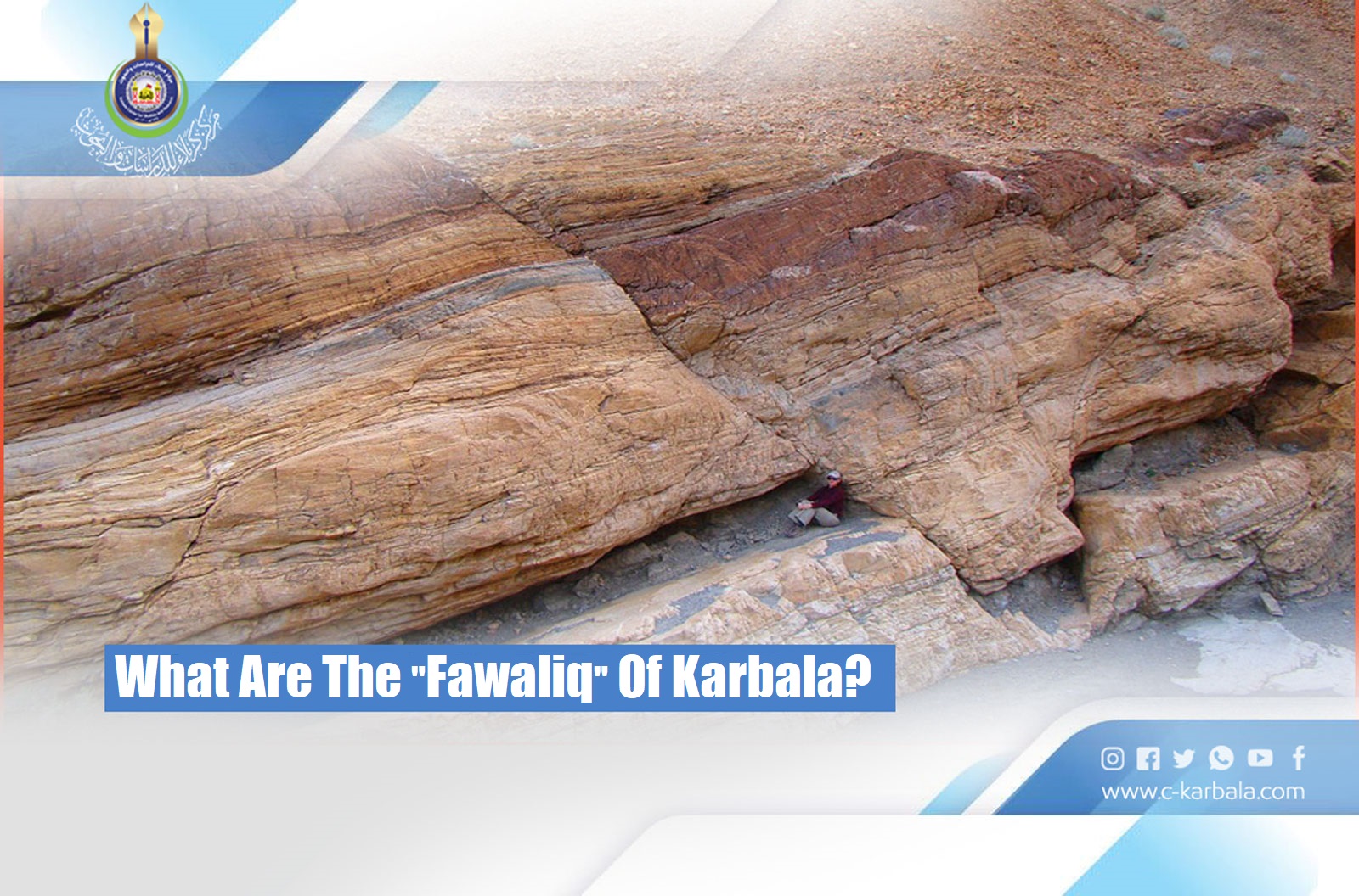
The research teams dispatched by the Karbala Center for Studies and Research at the Holy Shrine of Imam Hussain as part of its efforts to study, document, analyze, and archive all the landmarks of the holy city of Karbala, stated that there are several geographical faults aka "Fawaliq" that cut across the areas covered by the study.


These faults, as they were referred to in the volumes of the "Karbala Civilizational Encyclopedia" issued by the KCSR, were included three groups according to their geographical directions, namely:


1- The faults with an “east-west” direction, which are considered the oldest faults in the region. The most important of which is the “Abyad” fault that appears in the west of the study area, then extends along the “Abu Khamsat” valley. The fault continues towards the far west to intersect with the Iraqi - Saudi borders.


2- The faults with a "North-East-Southwest", the most important of which is the "Khar" fault, which is located along the "Al-Khar" Valley.


3- The faults with a "northwest-southeast" direction, which are among the most recent faults ever. The most important of which is the "Euphrates" fault that cuts across the northeast of the study area and is located along the western side of the Bahr al-Najaf valley.


Source:

Mawsueat Karbala Al-Hadharia "Karbala Civilizational Encyclopedia".

Historical Axis, Department of Islamic History

First Edition

A publication of Karbala Center for Studies and Research

 [Vol. 1, Pg. 124].


Facebook Facebook Twitter Messenger Messenger WhatsApp Telegram Viber Email
Related topics
2020-12-20 1935
2023-01-12 1824