The morphological stages experienced by the Arab Islamic city of Karbala were classified into five or six stages according to the nature and history of the city and its speed of growth as well as its ability to overcome time by taking advantage of the characteristics of its location.
In order to identify the most important stages of the city of Karbala, there is a need to identify the features of each stage and its impact on the city in all dimensions:
1. Stage of origin and emergence
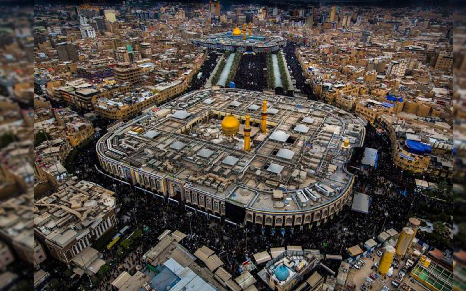
This stage is one of the longest morphological stages experienced by the city in general because it was full of ambiguity as a result of the lack of material heritage at the level of planning and formation. The history of Karbala that has an important geographical location, has gained a great importance since the beginnings of the establishment of the city to the stage of time not long before the battle of "Al-Taff" and the martyrdom of Imam Hussein (pbuh) on its soil in 61 Hijri. The city then has begun to emerge widely as its first nucleus was the holy shrine of Imam Hussein (pbuh) in which the governor of Kufa "Al-Mukhtar bin Abi Ubaida Thaqafi" has built a small dome of bricks and plaster over it in (65 Hijri - 685 AD) which became later the core that the city grown around it in a form of small and scattered houses until they became a fully inhabited city. This stage is one of the most important morphological stages in the life of the city because it represents the beginning of its inception and growth that declared the end of the era where this region was scattered housing in the valleys of the desert and the beginning of a new era arose after the population gathered around a new nucleus is the site of the shrine of Al-Imam Al-Hussein (pbuh).
It can be said that the development of the city was closely linked to the architecture of the holy shrine, as any architecture on the shrine would leave a positive impact in the city and vice versa, the holy shrine of Imam Hussein (pbuh) was subjected to multiple reconstruction operations throughout history that the first one of them was at (684 AD) which resulted in the construction of a village around the holy shrine as well as a group of small houses built of mud and palm trunks, this village took gradual growth for seventy years until the collapse of the Umayyad state (132 Hijri - 750 AD) and the emergence of the Abbasid state. In the same year, the city of Karbala began to grow faster than it was in the days of the Umayyads, the construction operations of the houses around the shrine have also begun to grow due to the religious factor as the city later became a center to attract the population to settle around the holy shrine, especially during the era of the Abbasid ruler "Al-Mamoun" who repaired the shrine at (193 Hijri - 809 AD), but the city suffered a major constructional setback in the time of the Abbasid dictator "Al-Mutawakil" at (236 Hijri - 820 AD) who ordered the demolition of the holy shrine of Al-Hussein and the surrounding area to prevent people from visiting it, the impact of this constructional setback has affected the formation of the city in terms of planning and social damage to the houses and shops throughout the duration of his era, but the city has finally breathed a sigh of relief after the arrival of the ruler "Al-Muntasir Billah" to power at (247 Hijri - 861 AD) and ordered to rebuild the shrine and houses and shops around it, it was only two centuries later that a small city of thousands of inhabitants grew up around the shrines of the Imams and thanks to the stability and tranquility that the city had witnessed during the construction of the first wall around the shrines and surrounding areas at (371 Hijri- 982 AD), the city was prospered and filled with markets as it took the circular shape of the wall around the two holy shrines.
In the year (479 Hijri - 1087 AD), the city wall was re-built during the Seljuk era, and the urban aspect of the city was further developed in the seventh and eighth Hijri centuries, especially in the days of the Gallerians. It became obvious during that important stage in the life of the city, the emergence of many important architectural forms that overshadowed its external appearance. The most important of them was the nucleus of the Imam Hussein's shrine, accompanied by a network of paths and twisted roads that link the houses and shops with the city center, which reflects the organic nature of the morphology of the city.
2. Growth Stage
The city of Karbala entered a new urban phase after Shah Ismail Safavi took control over on Iraq at 914 Hijri - 1508 AD. The city was expanded by the Safavid state, as it grown in a round shape around the holy shrines of the two Imams.
After the Ottomans conquered Iraq at (914 Hijri-1535 AD), the sultan Sulaiman al-Qanuni had shown a great interest to the city as he did whatever he could to honor the holy shrines and ordered to dig a river to irrigate the city and called it (The Sulaimaniyah River) after his name, which is called today (The Husseiniya River) and still watering the areas of the city until now.
During the seventeenth and eighteenth centuries, the city of Karbala was the focus of a long struggle between the Ottoman and Persian states, which negatively affected the development of the city. The city was subjected in 1801 AD to a fierce attack by the Wahhabis who broke into the city and destroyed its walls and looted its markets and burned the two holy shrines. In order to repel such attacks, the ottoman governor in Baghdad ordered to build a special wall around Karbala and made six doors for it, which are still known in the city until the present time, this wall remained until the late days of the Ottomans in Iraq. In 1857 AD under the Ottoman governor of Baghdad "Sardar Omar Pasha", and in agreement with the British government, the city became a "Sanjak=governorate" affiliated to Baghdad.
In 1869, the Ottoman governor "Medhat Pasha" had carried out major architectural reforms in the city, as he ordered a new expansion of the city outside its walls that led to the emergence of a new town called "The Abbasia", this area was also expanded later into two towns named the eastern and western Abbasia, therefore, the city of Karbala was divided into two sections, the first one is the old section or the so-called "Old Karbala", while the second section or what was called the "New Karbala", is the new section that was planned in the era of "Medhat Pasha" in 1869 and was built in an elegant architectural style.
The city of Karbala has moved to the ranks of Iraqi middle cities in 1880 after providing it with plans for its streets and neighborhoods and shops and linking it to all neighboring small towns.
The head of the Pennsylvania mission in Iraq at 1892 has described the city as a prosperous city that expanded outside its old walls and filled with large streets and state-of-the-art sidewalks, the city has a population of 60 thousand people at that time, and through this urban development made by the city, its urban features has become clearer, not to mention its success to dispose its old physical structure (the wall) and expands outside it, thus announcing its departure from the organic morphology to a comfortable expansion outward.
3. The Stage of Continuity and Completion
This stage is an important stage in the life , inhabitants and services of the city, because its structure has been integrated on constructional level and emerged to the public after suffering a lot of neglect. The importance of this stage came from that Iraq has moved from the foreign occupation authority (Ottoman and British) and witnessed the resurrection of the urbanized modern state in 1921 as the reconstruction in the city had begun to take a new direction as the other large cities in Iraq , introducing new methods of construction as well as modern patterns of urbanization especially in the buildings that were developed outside the boundaries of the old city, the newly constructed areas had expanded separately from the narrow alleys and twisted roads that characterized the old part of the city, which encouraged the population growth into (44150) citizens according to 1947's residential census.
The city has connected in 1923 to a branch of the Baghdad - Basra railway with a length of (38.5 km) at the main line that passes through the "Hindiyah Dam", and resulted later to the establishing of a railway station south of the city, thus creating a new factor for the expansion of the city and led to a more expansion to the south and more population growth as well as further expansion in neighborhoods. At the end of the 1940s, new residential areas had been distributed at the western and southern parts of the city and resulted in the establishment of "Al-Hussein" neighborhood in 1958 south of the city and the "Mu'alimeen" neighborhood in the late 1950s, followed by the neighborhoods of Al-Abbas, Saadia, Al-Jami'yah and Al-Ansar. The area of the city was estimated at about 25 km2 by the end of the 1950s. In 1958, the Greek Duxiades Foundation had laid out a plan for the city of Karbala, which included the upcoming stages of its urban development until the year 2000, but was not implemented except in some aspects, the city's morphology was characterized in the 1960s of the last century with advantages that above the previous morphological stages and without a doubt, this stage is one of the most important stages of the city because it is the outcome of what the city has reached regarding the urban structure, the population and constructional integration that crystallized the city's public infrastructure and its rapid growth and expansion of the residential stores as well as the increase in its population since the economic development and growth faced by the city as a result of its strong commercial and tourism based economic which was closely linked to the religious function of the city since its inception until now.
The city has continued to expand to the south-east, north-west and to the current and future growth axis until it has absorbed an important part of the basic plan prepared for it until the year 2000 . The city's area at this stage was about 52 km2, supported by developing of new residential neighborhoods such as Al-Wafaa, Al-Milad, Al-Tahadi, Al-Nasr, The Compounds, Al-Atebba'a, Al-Quds, Al-Risalah, Al-Mu'alimeen, Al-Mudara'a and others. The shape of the city has kept continuing to change outside the traditional center to take the shape of the flat area flattened by wide streets that linking its residential stores on one side and to the central area on the other, therefore, the city has seen many urban plans during these historical stages that can be considered as important plans that changed the life of the city and its urban infrastructure as the most prominent of which are the following:
The governor Medhat Pasha's Plan in 1869
The Ottoman governor Medhat Pasha was known that he was not like the other Ottoman governors who ruled Iraq during the five centuries of the Ottoman Empire, but was one of its greatest. He was famous for his passion with the aspects of urban life and civil reform, taking the tradition of European life as a way of reform. Many of Iraqi cities, such as Baghdad, Nasiriyah, Karbala and others, have seen major urban and civil reforms during his era as he was able to provide Iraq with new architectural features, including what was applied in the city of Karbala, which the governor visited in 1869, and ordered the demolition of part of the surrounding wall especially of its southern and south-western parts in order to ease the way for more urban reforms and to reduce congestion and constructional density that the city witnessed in that period. So he expanded new urban construction with modern planning and allowed the city to emerge from its isolation inside the wall and allow it to expand freely to its southern parts.
The Greek Duxiades Foundation's Plan in 1958
Iraq has used many companies specialized in city planning with the planning of many of its cities, the Greek Duxiades Foundation was one of the world's most famous companies in the field of urban and constructional planning. All the design works and planning conducted by this foundation in Iraq has carried the philosophy of American architecture that was applied in many provinces such as Baghdad, Erbil and Karbala. In 1956, the Iraqi Reconstruction Council entrusted the Duxiades Foundation to develop the basic plan for the city of Karbala after the increase of population and urban expansion in it. The Foundation has ran all the field inspections and comprehensive studies on every sector in the city and prepared its final report on the urban situation of Karbala, which includes an integrated study, proposals and a set of recommendations. The study was titled "The Future of Karbala City" which was a detailed field study about the nature of the geographical, social, demographic and service reality of the city of Karbala with detailed on-the-site maps. The Duxiades Foundation has relied in the development of the plan of the city of Karbala on the line of square angles, which provide the possibility of adding new urban extensions in the future. At the level of housing proposals that the foundation provided to the city of Karbala is the urban extension towards the south-eastern side of the city which was represented by the emergence of many new residential neighborhoods, the most important one of them was "Al-Hussein neighborhood" which was considered as the most easy axis in the expansion of the city. As for the increase in population, the foundation expected rapid population increase due to high rates of migration, In terms of services, the study suggested transforming the traditional city center into a center that includes religious and cultural uses only. It also recommended the abolition of all private properties and transferring their residents to new residential areas and neighborhoods.
The Ministry of Local Government's Plan in 1971
The General Authority for Urban Planning of the Ministry of Local Government at the time has presented an urban plan for the city of Karbala. This plan included an important amendment to some of the recommendations of the Duxiades Foundation Foundation. This plan included two main objectives:
The first objective was the highlighting of city urban growth's direction in two main axes which are toward the south-eastern road of the city (Karbala-Najaf road) and toward the north-western road (Razzaza Lake road).
The second objective was the new expansion of the city by establishing new neighborhoods and expanding the highways connecting the residential districts with the city center.
The Project of The Development of The Two Holy Shrines in 1977
It is one of the leading urban projects carried out by the Ministry of Planning to deal with the crises in the central region of Karbala city, which sought to open roads and main streets in the city to link and secure communication between the two holy shrines as the paths between them do not meet the purpose because of the narrowness and lanes of their paths, not to mention their low capacity regarding the absorption of pilgrims and visitors. This project was able to divide many of the important streets, which still exist to the present time, such as the "Qibla Street" and the "Sahib Al-Zaman Street" as well as other secondary streets.
The Ministry of Local Government's Plan in 1978
In August 1978, the Department of Planning and Engineering has conducted an extensive planning study on the urban and demographic development of the city of Karbala under the title "Karbala City- An analytical field study of the Status quo" which was a reliable source throughout the 1980s in guiding the urban growth of the city. The study has also confirmed the direction of the general plan of the city towards the two former axes (Najaf Road) and (Razzaza Road) being the best axes of urban expansion. The recommendations of this government plan had been implemented by the authorities responsible through the distribution of residential areas to the population in that period, therefore, it resulted in the emergence of many new neighborhoods such as the Al-Muwadhafin neighborhood 1, Al-Muwadhafin neighborhood 2, Al-Ma'amalachi, Al- Usra and many others, so the residential neighborhoods of the city of Karbala have reached more than 40 neighborhoods, mostly within the island sector which has become the new axis of housing and urban development.
Sources:
1. The Dictionary Of Countries - Yaqoot Al-Hamawi
2. Taj al-Arous- Al-Zubaidi.
3. Karbala And The Holy Shrine Of Al-Hussein - Abdul Jawad Al-Kilidar.
4. The Noblemen's Destination In The History Of Karbala - Abdul Hussein Al-Kalidar.
5. Al-Hussein City- Mohammed Hassan Al-Kilidar.
6. The Heritage Of Karbala - Salman Hadi Al-To'ama.
7. Nahdhat Al-Hussein - Hebat Al-Din Al-Shahristani.
8. "Loghat al-Arab" Journal - Father Anastas Karamli.
9. The City Of Karbala: A Study In The Origins And Urban Development - Dr. Riadh Al Jumaili.
10. Karbala in the Ottoman archive - Dilak Faya.
11. Karbala's Comprehensive Cultural Encyclopedia – The Karbala Center for Studies and Research.
12. Statistical Data – The Iraqi Ministry of Planning.
13. The Supreme History Of Karbala - Abbas Al-Lahaf.